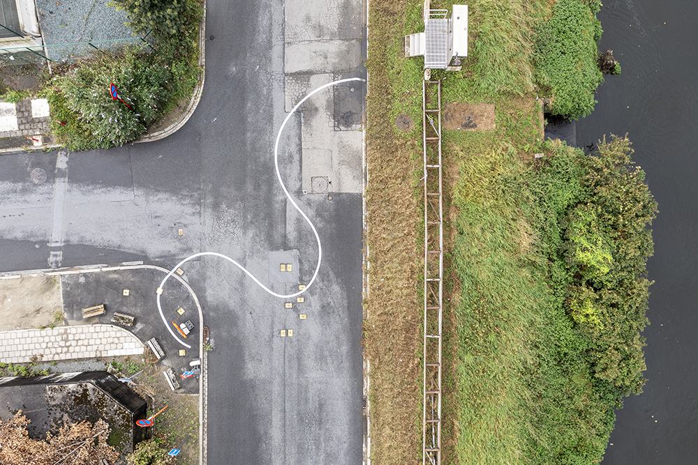
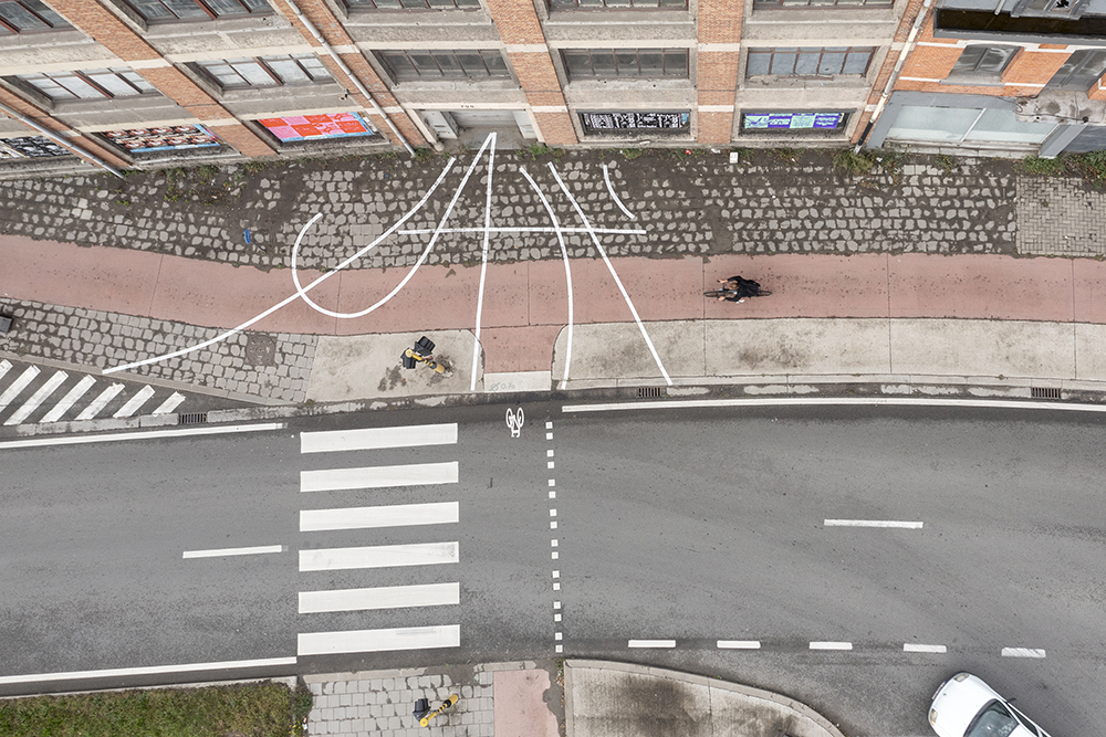
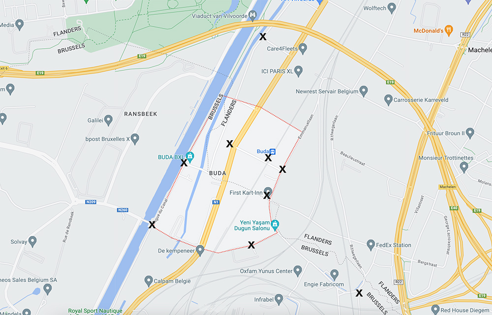
Border Buda, Brussels, Vilvoorde, Machelen, 2023
Nine ground drawings, paint
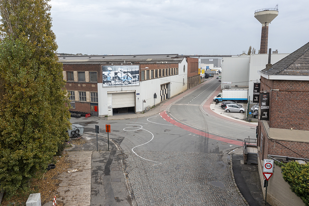
The industrial area Buda, in the north of Brussels, crosses over the municipalities
of Brussels (Haren), Machelen and Vilvoorde. It is an area with a rich history, going
back to pre-Roman times, now a grey industrial zone through which the Vilvoorde
viaduct, the railway, river Zenne and the Canal passes, while close by planes take
off from Brussels Zaventem airport. Buda has few residents, multiple vacant buildings,
and often no sidewalks for pedestrians, making it a place for the public to pass
through, past, or over rather than to stay in.
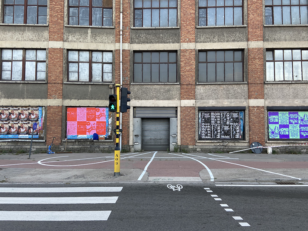
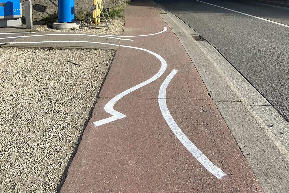
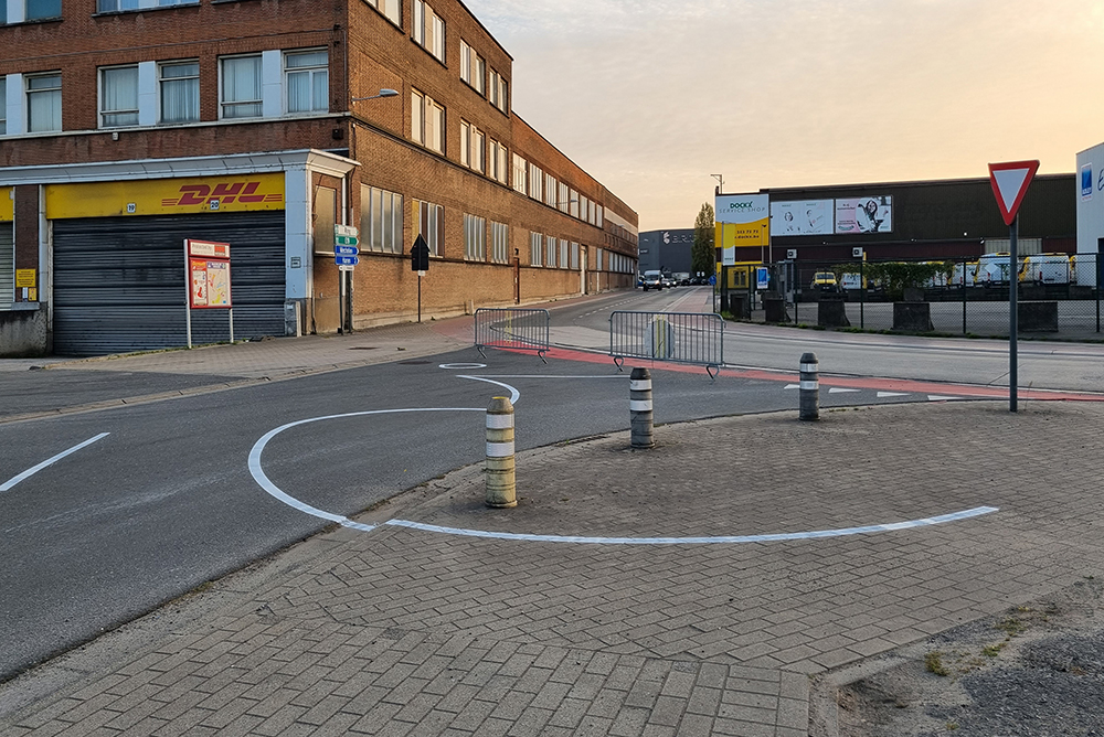
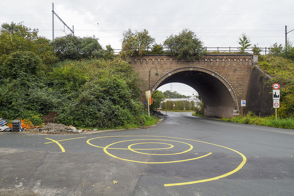
Commissioned by Border Buda, a long term initiative to regenerate the area, I made
nine ground drawings that span Buda, and can be accessed by foot, while crossing
over municipal boundaries and borders. The drawings shape a route that can be the
starting point for a new way to navigate, embody, and draw together different locations
in the area. Each spot is chosen to mark locations of interest or significance, and
marked by gestures that relate to the location itself while allowing the drawings to fit
together, like a sequence or a sentence. The word Landmark originated from boundary
markers dividing lands and kingdoms, which over time became more generally used
as conspicuous markers in the landscape for findings one’s way.
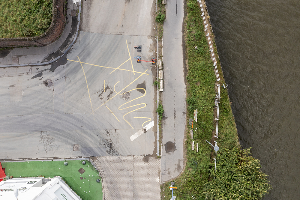
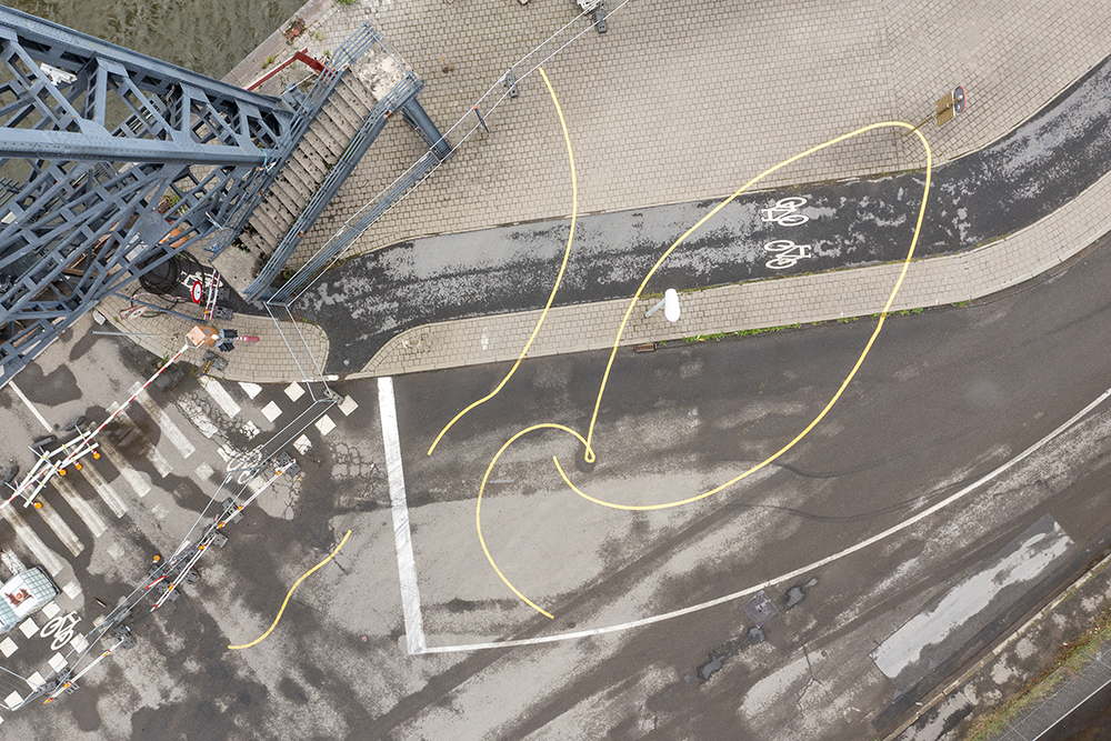
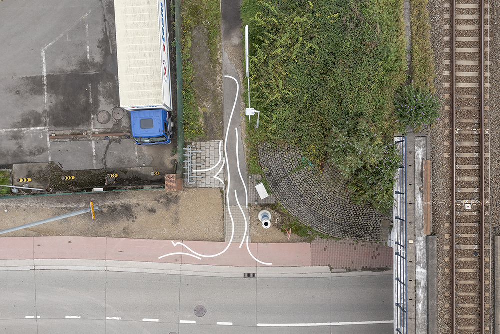
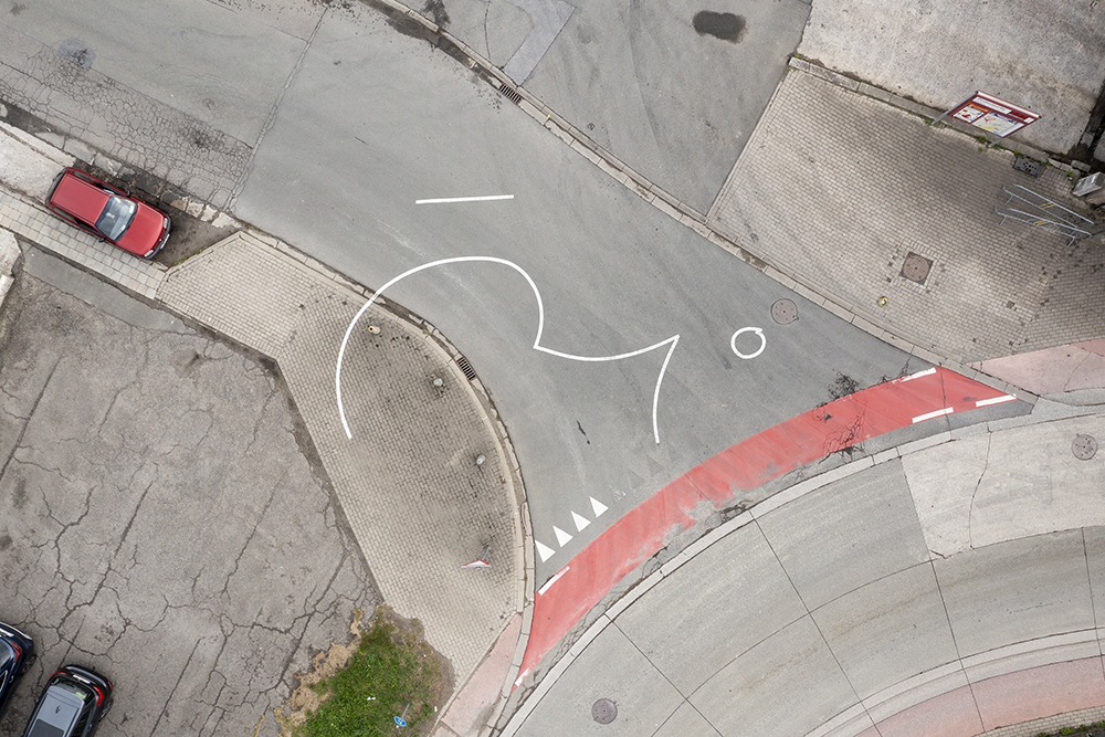
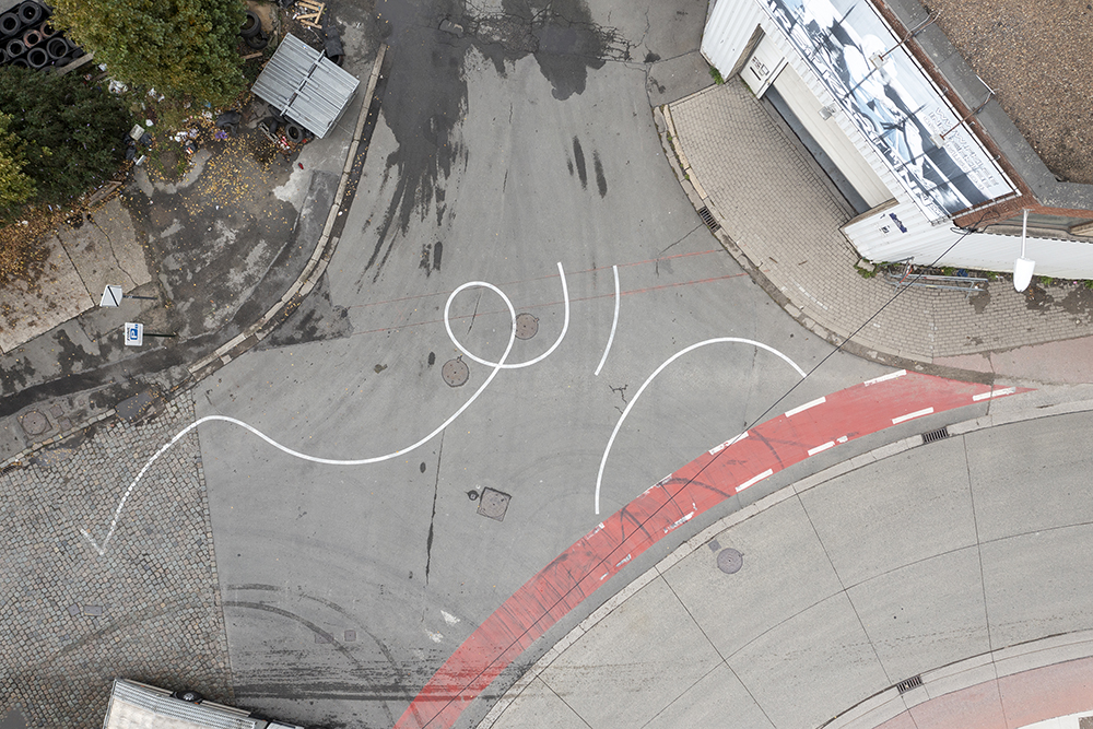
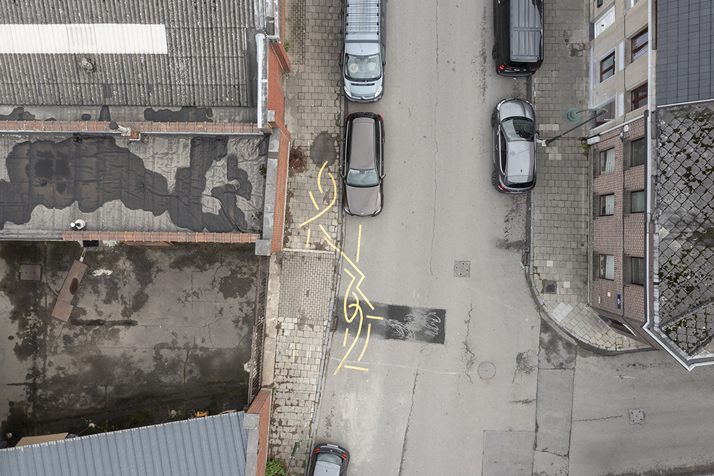
The drawings are made through moving a paint marker over the ground––crossing
over roads, parking lots, cycle paths and sidewalks––in response to the use of the
area, while fading over time in relation to the intensity of passing traffic. Viewers can
encounter the drawings from various directions and starting points. Along with this a
booklet documents the drawings from the ground as well as additional views from
above, giving a broader view of the area, and suggests a possible order in which the
drawings can be followed by foot.
It is not a coincidence that an early form of transportation, the development of the
railway, was the impetus for the standardisation of time, to synchronise timetables
and make movement more efficient. This work aims to take a step back, slowing
movement through the area, allowing time and space to be embodied as a register
of movement.
–––––
Curated by Anna Laganovska and Koi Persyn
Coordinated by Sarah Demoen
Aerial photography by Luuk Kramer